


")


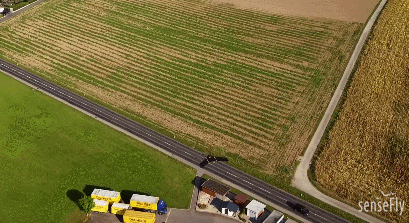
Here is a photogrammetric mapping drone optimized for surveying and geospatial applications. The eBee Plus has a senseFly S.O.D.A. RGB camera and built-in RTK/PPK functionality. It can fly for 59 minutes and cover up to 2.2 square kilometers in a single flight. It has a max coverage of up to 40 km2.
More like this ➡️ here
The eBee Plus Drone - Aerial Efficiency, Photogrammetric Accuracy

The drone comes with eMotion 3 for mission planning and management. You can find the full specs here.
*Our articles may contain aff links. As an Amazon Associate we earn from qualifying purchases. Please read our disclaimer on how we fund this site.


