


")


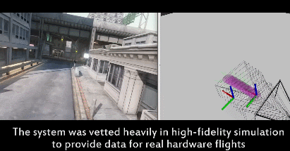
Plenty of drones with come sensors, GPS, and all kinds of fancy features to avoid obstacles and fly around without an accident. Still, flying drones through cluttered spaces is not always easy. Existing approaches rely on mapping to tell drones exactly where they are. A group of MIT researchers have developed NanoMap, which allows drones to fly 20 miles per hour through dense environments such as forests.
The system considers the drone’s position to be uncertain, so it models by taking that into account. NanoMap:
uses a depth-sensing system to stitch together a series of measurements about the drone’s immediate surroundings. This allows it to not only make motion plans for its current field of view, but also anticipate how it should move around in the hidden fields of view that it has already seen.

NanoMap uses depth-sensing to measure its surroundings but also searches the history of all its view to anticipate how to move in the places it can’t see. More info is available here.


